Picture an uncrewed aircraft holding over the same patch of sky. One aircraft stays a short while and heads home, while another stays over the same sky for a long time. What is the difference? Both look at the same place, but the one that stays longer can keep watching the changes that happen in between.
That is why endurance carries so much weight for drones used in reconnaissance and surveillance. This article starts with the meaning of intelligence, surveillance and reconnaissance (ISR). It then looks at how staying aloft ties in with surveillance and what the sensors on these drones look at, using public material from governments and international bodies. It also covers what changes when no one is on board, public cases from Korea and the North Atlantic Treaty Organization (NATO), and the debate over how drones are grouped.
The term ISR: intelligence, surveillance and reconnaissance
ISR stands for intelligence, surveillance and reconnaissance. NATO describes ISR as the foundation for all military operations and says its principles have been used in warfare for centuries. It is much older than the drone.
The three words sound alike, but each has its own job. Here is how NATO defines them.
- Surveillance: the persistent monitoring of something.
- Reconnaissance: information-gathering done to answer a specific military question.
- Intelligence: the final product made from surveillance and reconnaissance, combined with other information.
What separates surveillance from reconnaissance is time and specificity. Surveillance is a longer, more deliberate activity. Reconnaissance missions are generally quick and aimed at specific information.
Think of the difference between standing at a crosswalk all day watching who passes and making a quick trip to see whether a road is blocked. The first is closer to surveillance, the second to reconnaissance. The real thing is different in one way. No single person does all of it: collecting, analyzing and deciding are done by separate people.
What is collected does not become intelligence on its own. Intelligence specialists analyze the material from surveillance and reconnaissance and fuse it with data from other sources to produce intelligence. That intelligence goes to military and civilian decision-makers, particularly for planning and carrying out operations.
NATO names three main actors in this flow. Collection assets gather information, analysts exploit and analyze information from many sources, and decision-makers use the intelligence to make decisions. A drone belongs in the first box, as a collection asset.
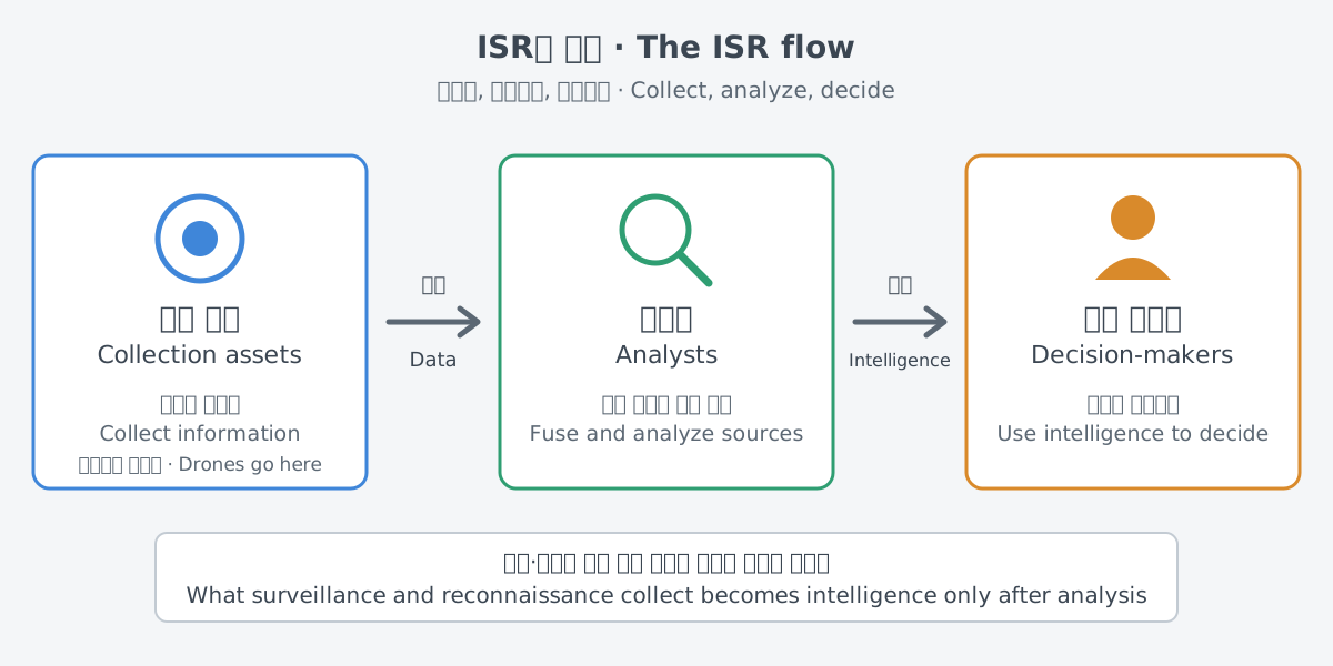
Surveillance and reconnaissance can include direct observation by people as well as electronic observation with technology such as satellite imagery, uncrewed aircraft systems and passive sensors.
The word drone has a formal meaning too, in a U.S. Department of Defense definition cited by the Congressional Research Service (CRS). Under it, an unmanned aircraft (UA) does not carry a human operator and can fly with or without human remote control. An unmanned aircraft system (UAS) also includes the equipment, network and personnel needed to control the aircraft. The Department of Defense uses the terms uncrewed and unmanned interchangeably.
Why staying aloft matters
The definition of surveillance already holds a clue. Surveillance is persistent monitoring, and time is what sets it apart from reconnaissance. The longer an aircraft stays in the sky, the longer it can keep watching the same place.
Endurance is how long an aircraft can stay in the air once it takes off. A 2012 CRS report calls intelligence gathering the traditional mission of uncrewed aircraft systems.
Early controllable drones lofted cameras so that units in the field could see opposing forces beyond their direct line of sight. Later, longer-endurance systems brought the ability to keep watching distant and moving targets. Their use grew from a quick look to a long watch.
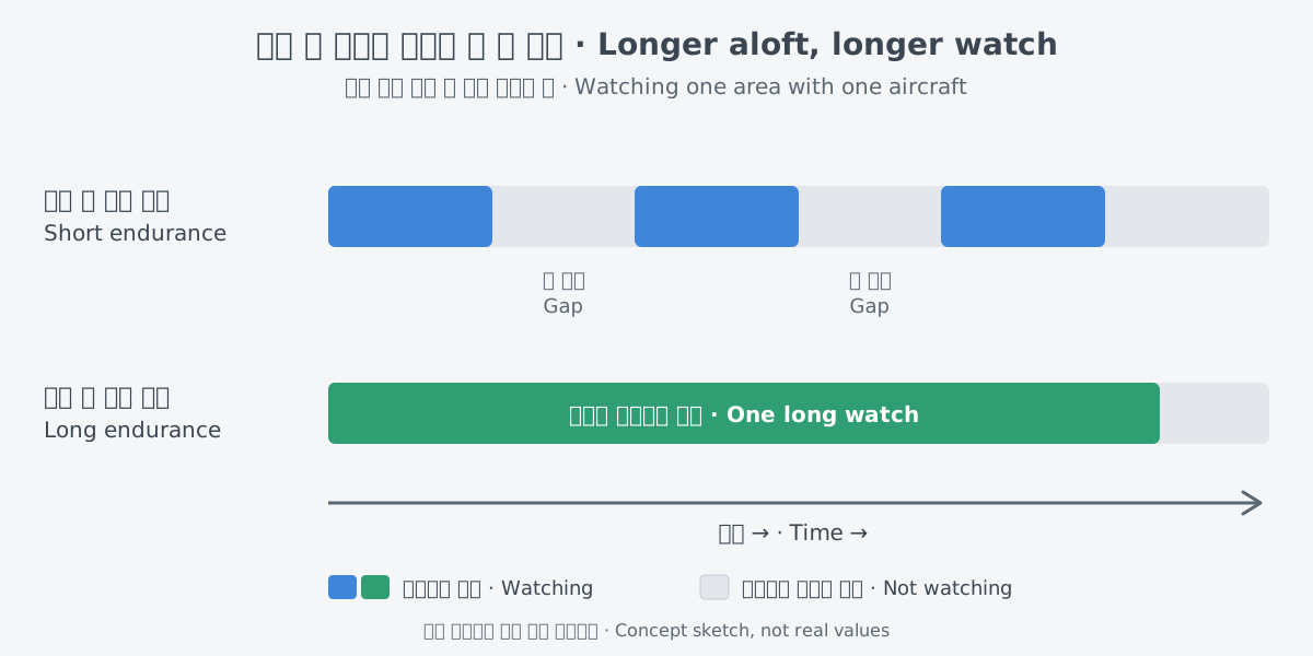
Having no one on board also ties in with endurance. One advantage often claimed for drones over crewed aircraft is that their flight capabilities, such as endurance, are not bound by human limits. Commanders want uncrewed systems for their versatility and persistence, the same report adds.
Public records from science flights show how long a long-endurance drone can actually stay up. NASA's Armstrong Flight Research Center operates two Global Hawk uncrewed aircraft for high-altitude, long-duration missions. The Air Force handed them over to NASA in 2007, after the developmental flight test program ended. Between 2010 and 2017, the aircraft were used for Earth observation research.
NASA points to endurance and range as features of the aircraft. Nominally, they fly missions of up to 24 hours and cover about 8,500 nautical miles. In the five years after their first NASA checkout flight in 2009, the two aircraft made 133 flights totaling 1,644 flight hours. That works out to almost 12.5 hours in the air per flight.
What did all that flying produce? In 2015 NASA and the National Oceanic and Atmospheric Administration (NOAA) ran the SHOUT program. It looked into whether a high-altitude, long-endurance (HALE) aircraft could be used to sense weather hazards. When NOAA fed atmospheric data gathered from the cruise altitude of about 60,000 ft down to the ocean into its forecast models, storm track and intensity predictions improved greatly.
NASA's hurricane mission HS3 also relied on long flights. Over three years of measurements above Atlantic tropical storms, it flew more than 600 hours, with 21 flights over 9 named storms. These numbers come from Earth science work, not from military reconnaissance or surveillance missions.
What sensors look at: the broad kinds
Staying aloft is of little use without a way to see. Even the early drones were, in the end, a way to lift a camera into the sky. The value of a reconnaissance or surveillance drone shows only when the aircraft and the sensors it carries are taken together.
Collection assets such as NATO's surveillance aircraft gather information using radar, observation satellites, electronic assets and special ground reconnaissance troops. The table groups the examples found in public sources into broad kinds.
| Kind | Examples in public sources | What it gives |
|---|---|---|
| Human eyes | Soldiers on the ground, or crew on a plane or ship, watching directly | What people see for themselves |
| Camera images | Cameras lofted by early drones, the high-performance cameras and sensors on Korea's MUAV | Images of scenes beyond line of sight |
| Radar | The synthetic aperture radar (SAR) on NATO's RQ-4D | Reconnaissance and surveillance day and night, regardless of weather |
| Science instruments | Instruments flown over hurricanes on NASA's Global Hawk | Cloud structure, pressure, temperature, winds, humidity and rainfall at different heights |
Radar gets its own row for a reason. NATO says its Intelligence, Surveillance and Reconnaissance Force (NISRF) can carry out reconnaissance and surveillance day and night, independent of the weather, thanks to the RQ-4D's synthetic aperture radar (SAR). When a long-endurance aircraft carries a sensor like this, its watch is broken less by weather and darkness.
The last row of the table is not military. During HS3, the instruments on the Global Hawk measured cloud structure, pressure, temperature, winds, humidity and rainfall at different heights. It shows that, depending on what is carried, the ability to stay aloft can serve science as well.
What changes when no one is on board
The word "uncrewed" makes it easy to think no people are needed at all. In fact, a drone works as part of a system. That system generally includes a ground control station, a ground crew with remote pilots and sensor operators, communication links, and often several air vehicles.
Around the time of the 2012 CRS report, most uncrewed aircraft systems needed at least two ground operators. One flies the aircraft, and the other controls the sensors.
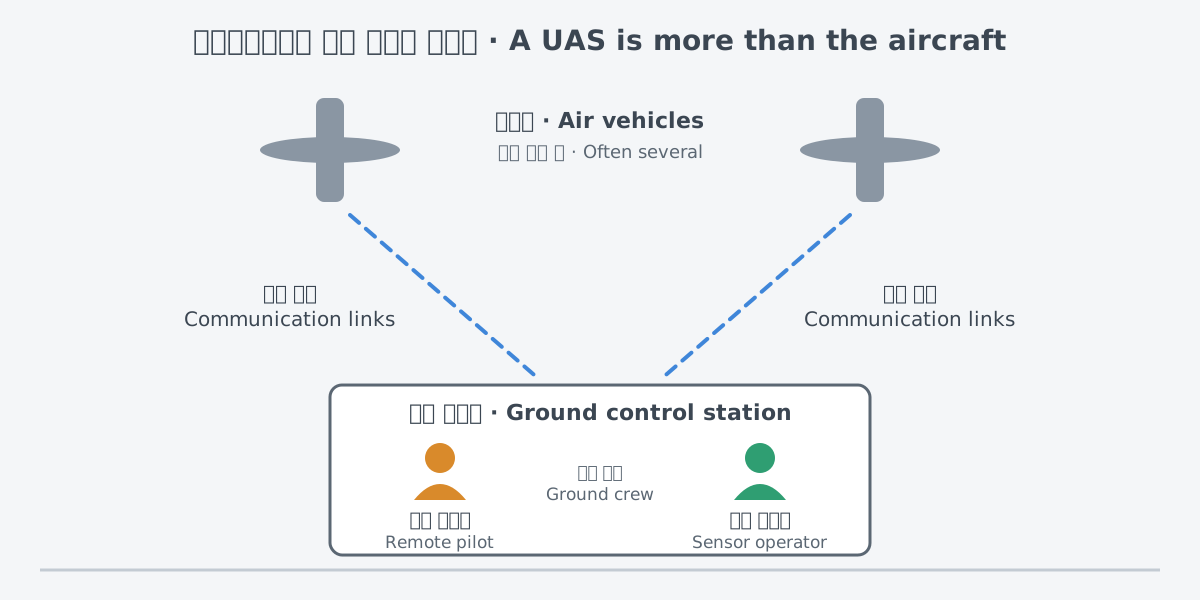
Even an aircraft that flies itself stays tied to the ground. NASA's Global Hawk flies autonomously, following a flight plan loaded before takeoff. Its flight is still managed, and its systems are monitored, from a ground control station through satellite and line-of-sight communication links.
There are clear gains when no one is on board. No pilot's life is put at risk. Drones are also said to protect pilots by taking on "dull, dirty, or dangerous" missions that do not need a pilot in the cockpit.
There are costs as well. Drones may be cheaper to buy and run than crewed aircraft. But CRS points out that the lower purchase cost can be weighed against a greater tendency to crash. Less risk to the crew on board also has to be set against the complications and hazards of flying uncrewed aircraft in airspace shared with crewed ones.
CRS cites the Congressional Budget Office (CBO) on this point. Even with no pilot on board, the advanced sensors on these aircraft are very expensive and cannot be treated as expendable. Having no one on board does not make the equipment something that can be lost lightly.
Public cases and policy discussion
Reconnaissance drones have a longer history than many expect. Drones were first tested during World War I, although the United States did not use them in combat in that war. In the 1960s, autonomous drones were used for reconnaissance in the Vietnam War and for strategic reconnaissance over denied areas.
The Firebee first flew in the 1950s as an aerial gunnery target and was used in the 1960s as an intelligence-collection drone. The same aircraft went from target to intelligence collector.
The Predator made its debut in the Balkans conflict, flying surveillance missions such as monitoring area roads for weapons movements. According to the 2012 CRS report, the Department of Defense's inventory of unmanned aircraft rose from 167 in 2002 to nearly 7,500 in 2010.
In a 2026 press release unveiling a production aircraft, Korea's Defense Acquisition Program Administration (DAPA) presented the Medium-altitude Unmanned Aerial Vehicle (MUAV) as the country's first strategic-class drone. It was developed and produced by Korean companies under DAPA and the Agency for Defense Development, and DAPA put its domestic content at 90%.
DAPA said that once the MUAV is fielded, Korea will have its own capability for real-time surveillance with high-performance cameras and sensors, 24 hours a day, 365 days a year. This is the agency's description of what it expects after fielding, not a report of results. After acceptance testing by the Air Force, the MUAV is scheduled for delivery in stages from 2027.
Earlier, in December 2024, the production facility for the MUAV was completed and assembly began. DAPA expected the MUAV to be used in many areas, including the navy and coast guard, after modification and further development.
NATO's NISRF was first set up in 2015 as the NATO Alliance Ground Surveillance Force. With a fleet of five RQ-4D "Phoenix" remotely piloted aircraft and a team of analysts, it provides rapid, permanent and long-range surveillance on land and at sea in all weather.
The 2026 NATO Summit in Ankara included a Defence Industry Forum. There, Denmark, Finland, Germany and Norway announced plans to buy up to five MQ-4C Triton high-altitude, long-endurance uncrewed aircraft to strengthen NISRF. It is a public example of a plan to add long-endurance aircraft to NATO's shared surveillance force.
With drones this varied in size and use, how are they grouped? The Department of Defense sorts uncrewed aircraft systems into five groups, Group 1 to Group 5, by maximum takeoff weight, operating altitude and speed. This approach, developed in 2007–2008, now appears as the "UAS Categorization Chart" in the joint doctrine publication JP 3-30, "Joint Air Operations."
At first, the groups followed mission profiles such as close-range, medium-range and strategic. With each new version, more weight went to physical and operational values such as weight and airspeed.
The dividing lines were chosen partly to line up with the Federal Aviation Administration (FAA) and so help bring military drones into the National Airspace System. The upper limit of Group 2, 55 pounds, is the same figure the FAA uses as the maximum takeoff weight of a small UAS. In most Department of Defense uses, a small UAS typically means an uncrewed aircraft that weighs less than 55 pounds. In the department's directive on countering small drones, however, every aircraft in Groups 1, 2 and 3 counts as a small UAS.
NATO's classification guide, first presented in 2009, divides uncrewed aircraft systems into three classes, Class I, II and III. Many other civil and military schemes exist around the world, and parts of them may or may not match the Department of Defense groups.
Opinions on the Department of Defense groups differ. Some analysts argue that the groups say little about other potentially useful traits, such as how automated an aircraft is, and that Group 3 is too broad. Others see the groups as more flexible than other approaches.
In the National Defense Authorization Act (NDAA) for Fiscal Year 2022, Congress directed the Department of Defense to review this classification and decide whether it needs changes. Even a table that sorts aircraft by weight and altitude carries questions about airspace, policy and technology.
What to read next
- The next article in the drones and uncrewed systems group (planned): it moves on to a different kind of drone in the same group.
- "Radar: measuring distance and motion with radio waves": how the radar in the sensor table uses radio waves to measure distance and motion.
- "Electronic warfare: the invisible contest": the contest over the electromagnetic spectrum that the electronic assets NATO lists as collection means work in.